North East Hertfordshire Labour Party The Labour Party covering Letchworth, Baldock, Royston, Buntingford and surrounding villages
About North East Hertfordshire Labour
North East Hertfordshire Labour Party
The constituency was created for the 1997 general election largely from parts of the abolished County Constituency of North Hertfordshire, including Letchworth, Baldock and Royston. It also included rural areas of the District of East Hertfordshire transferred from the constituencies of Hertford and Stortford and Stevenage.
General Elections
In 1997 and in 2001, Labour came close to winning the constituency. The Tory majorities were 3,088 and 3,444 respectively. In common with most constituencies, we lost voter share in 2005. The majority of this lost share went to the Liberal Democrats.
In 2010, we lost further voter share, both to the Liberal Democrats and the Conservatives. For the first time since the formation of the constituency, the Conservatives had an overall majority of the votes and Labour was pushed temporarily into third place.
In 2015, we increased the Labour vote slightly and returned to second place, but the Tory majority was 19,080. This Majority has stayed very similar in 2017 & 2019 where North East Hertfordshire Labour bucked the national trend & kept our vote share and Second place. In 2019, like nearly every constituency, Labour lost ground, but our vote share fell by a modest 4.6%, which was a better performance than neighbouring constituencies.
Since its creation, the sitting Conservative MP has been Sir Oliver Heald. Although he initially accepted the Conservative nomination to stand at the next General Election, in January 2024, he indicated that he would not be standing.
The Constituency
Despite the nationwide boundary review, the constituency boundaries are unchanged for the next General Election. The constituency extends from Letchworth Garden City and Baldock in the west to the Pelhams in the east, and from Royston and Ashwell in the north to Little Berkhamsted and Letty Green in the south. It includes Walkern, Benington, Buntingford, Puckeridge, Standon, Thundridge, Watton-at-Stone and Tewin (see map below).
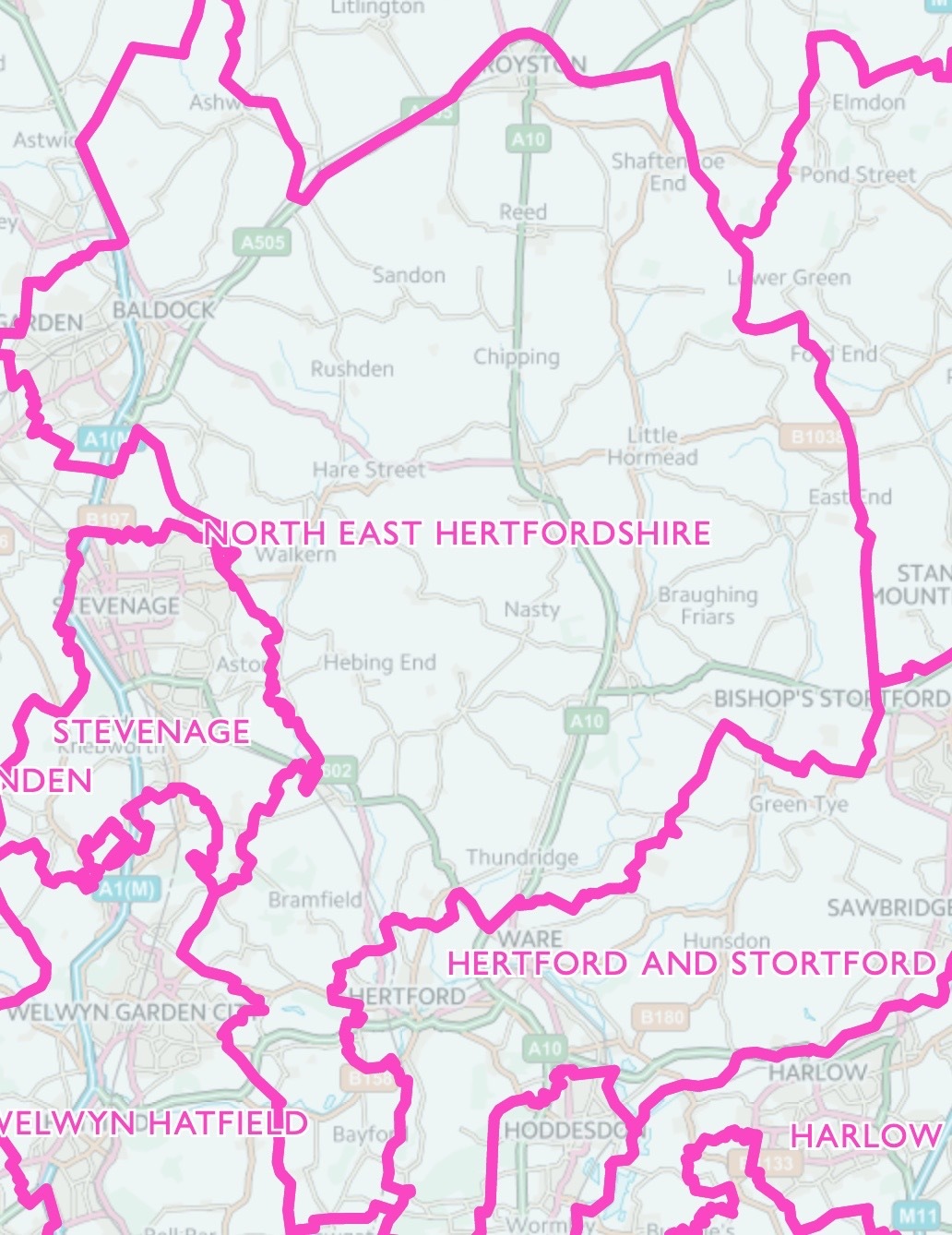
Image produced from the Ordnance Survey electionmap service. Image reproduced with permission of Ordnance Survey and Land and Property Services.